


"https://www.lowrance.com/assets/img/default-product-img.png?w=400&h=225&scale=both&mode=max"
C-MAP Precision Contour HD - Tennessee
SKU: 000-14809-001
000-14809-001
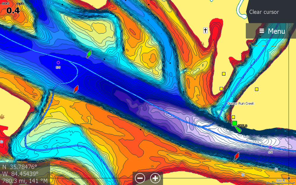
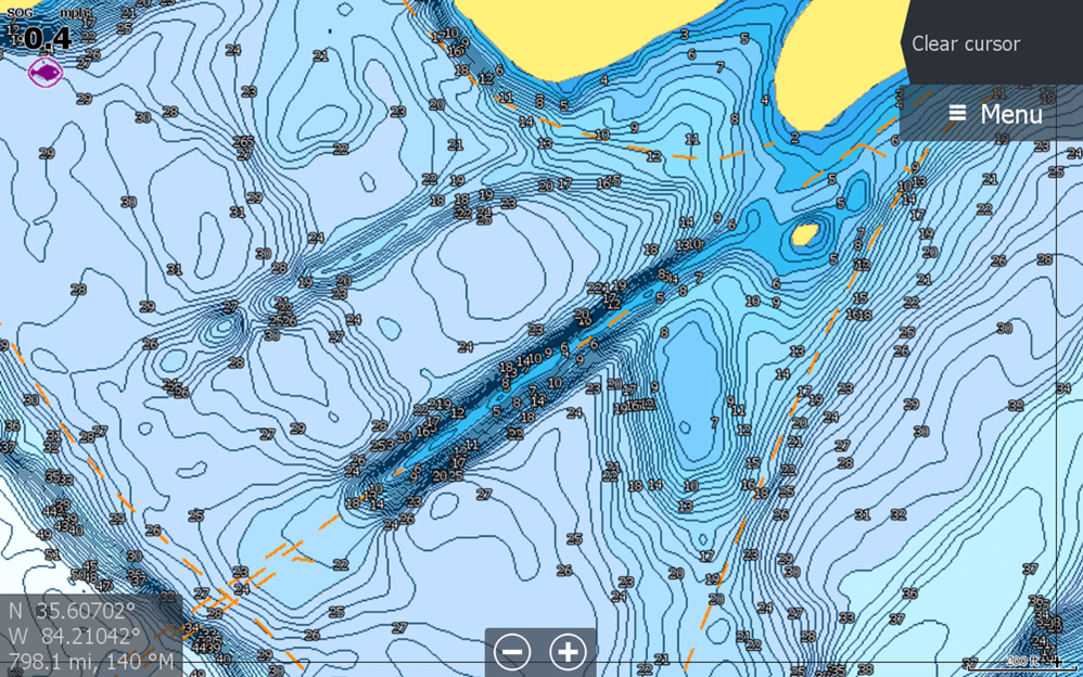
Whether fishing new water or your local lake, you will have an easier time getting on the fish with C-MAP® Precision Contour HD maps – the ideal fishing maps for serious anglers. Precision Contour HD maps bring together the best data from professional lake surveys, C-MAP Genesis Social Maps and traditional lake maps to deliver high-detail, statewide fishing maps with 1-foot contours.
Key Features
- Survey quality Contour Data - 1-foot contour coverage, visible even at wide zoom levels
- Custom depth shading – choose colors for specific depth ranges to highlight fishing-holding depths and/or hazard zones
- Points of Interest - includes traditional navigation information, C-MAP Navigation data, plus Fishing HotSpots waypoints and lakes-specific fishing tips and techniques
- High resolution satellite imagery – used to locate man-made fish-holding structure like boat docks. Available views include water and land, water only and land only.
- Preset Depth Shading Palettes, including Safety Shading
- Includes fishing regulations, records and ID photos
- Free 1-year subscription to C-MAP Genesis Edge Custom mapping service.
- Compatible with HDS LIVE, HDS Carbon, HDS Gen3, HDS Gen2, Elite Ti², Elite Ti and HOOK²*
- Surveyed waterbodies
- Chickamauga
- Kentucky Lake
- Douglas
- Fort Loudon
- Tellico
- Old Hickory
- Watts Bar
- Melton Hill
- J. Percy Priest
- Nickajack